In April 2019, I hiked the Manaslu Circuit Trek in Nepal, and it remains one of the most challenging, powerful trekking experiences of my life.
Wild, remote, and deeply cultural, the Manaslu Circuit is often called one of the best long-distance hikes in Nepal. And after hiking it myself, I completely understand why.
If you’re looking for a Himalayan trek with towering peaks, fewer crowds, authentic village life, and a real sense of adventure, this guide covers everything you need to know… how to get there, how to prepare, the best time to trek in Nepal, local culture, a detailed day-by-day itinerary with mileage and elevation gain, and exactly what gear to bring.
Where Is the Manaslu Circuit Trek?
The Manaslu Circuit Trek circles Mount Manaslu (8,163 m / 26,781 ft), the eighth-highest mountain in the world, located in west-central Nepal near the Tibetan border.
Manaslu is a restricted trekking region, meaning you must:
- Trek with a licensed guide
- Have at least two trekkers
- Obtain special permits
These rules help protect the landscape, wildlife, and centuries-old mountain culture.
How to Get to the Manaslu Circuit Trek
I began my journey by flying into Kathmandu, Nepal’s vibrant and chaotic capital.
From Kathmandu:
- We drove 7 hours by bus to Soti Khola, where the trek officially begins.
- The drive is long, dusty, and bumpy, but incredibly scenic, winding through river valleys and rural villages.
This rough journey is your first taste of just how remote the Manaslu region really is.
Best Time to Trek the Manaslu Circuit
🌸 Spring (March–May) — Best Overall
I trekked in April, and conditions were nearly perfect: clear skies, blooming rhododendrons, warmer days, and manageable snow at high elevations.
🍂 Autumn (September–November)
Cool, stable weather with excellent visibility… another ideal season.
🚫 Monsoon (June–August): heavy rain, leeches, landslides
🚫 Winter (December–February): extreme cold and heavy snow at Larkya La Pass
How I Prepared for the Manaslu Circuit Trek
The Manaslu Circuit is challenging, mostly due to its length and altitude.
Training tips:
- Long hikes with elevation gain
- Stair climbing and leg strength workouts
- Cardio (running, cycling, hiking with weight)
Altitude facts:
- Starting elevation: ~2,300 ft
- Highest point: 16,750 ft (Larkya La Pass)
- Slow ascents and acclimatization days are essential
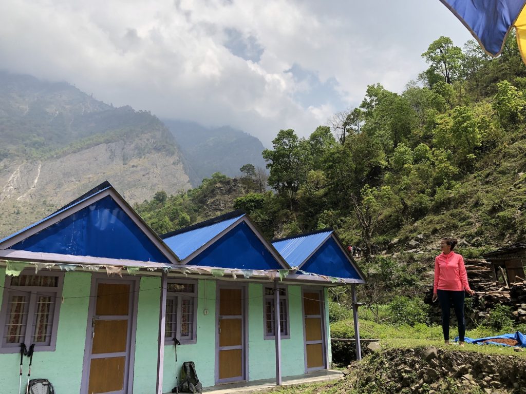
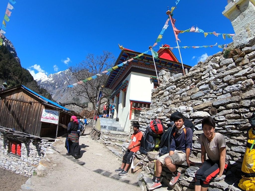
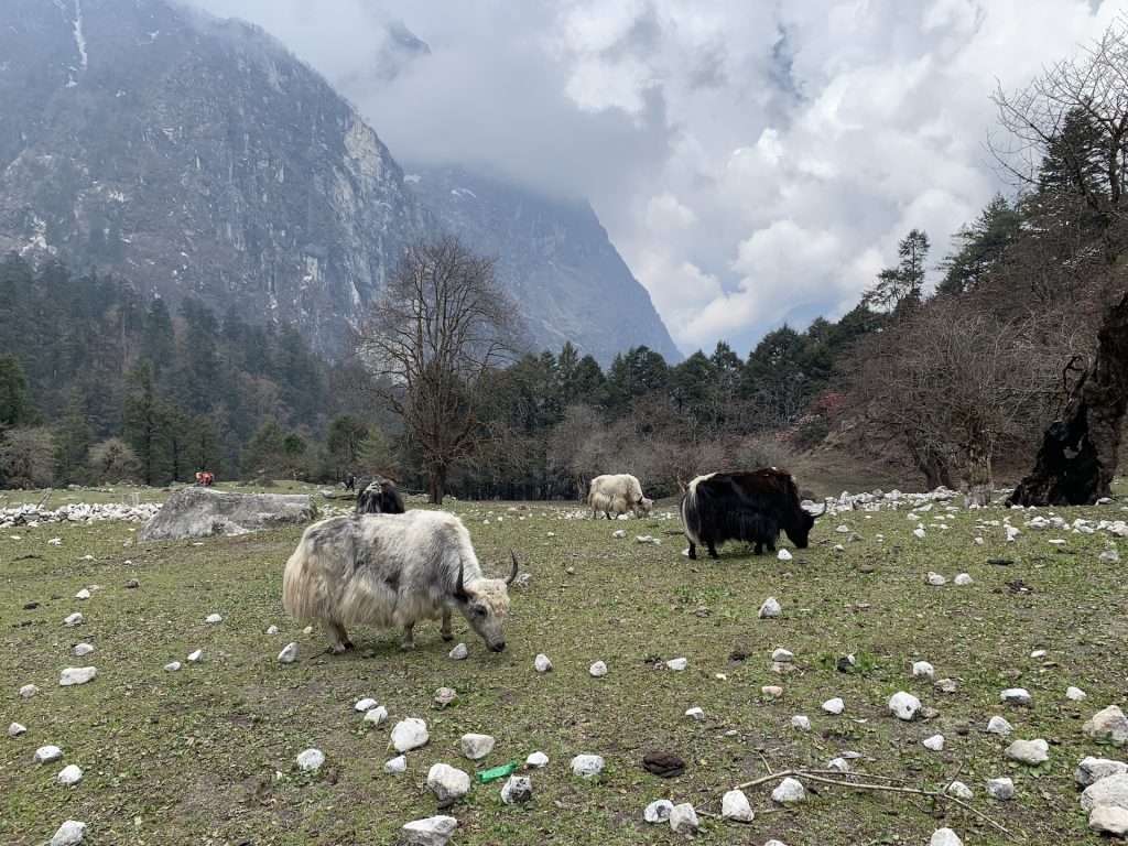
Culture Along the Manaslu Circuit
One of the most special parts of hiking the Manaslu Circuit is how deeply cultural the experience feels.
As I climbed higher:
- Villages became increasingly influenced by Tibetan Buddhism
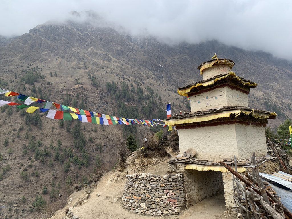
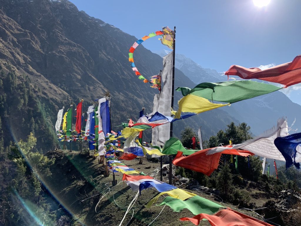
- Mani walls, prayer flags, monasteries, and chortens lined the trail
- Life felt simpler, quieter, and deeply connected to the mountains
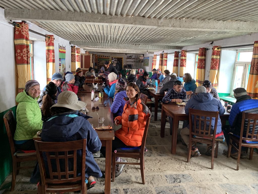
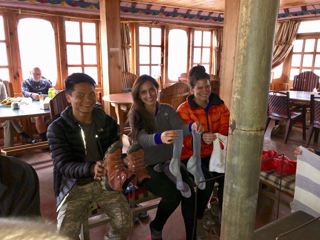
Staying in quaint teahouses and interacting with residents of the communities made this trek feel meaningful far beyond the scenery.
Manaslu Circuit Trek: Day-by-Day Itinerary
(Distances and elevation gains are approximate)
Day 1: Kathmandu → Soti Khola
- Hiking: None
- Driving distance: ~95 miles
The adventure began with a long, winding drive out of Kathmandu and deep into the Himalayas. The city chaos slowly faded into terraced hillsides, river valleys, and remote villages. By the time we arrived at the trailhead, dusty and tired, it finally sank in… I was about to hike around one of the world’s tallest mountains.
Day 2: Soti Khola → Machha Khola
- Distance: ~9 miles
- Elevation gain: ~2,300 ft
- Ending elevation: ~2,900 ft
My first day on the trail followed the Budhi Gandaki River through dense jungle, narrow paths, and swaying suspension bridges. The air was hot and humid, and the trail constantly climbed and dropped, keeping my legs honest. Waterfalls spilled down cliffs, and every turn felt like stepping deeper into Nepal.
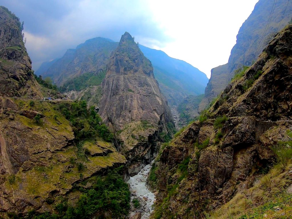
Day 3: Machha Khola → Jagat
- Distance: ~14 miles
- Elevation gain: ~3,000 ft
- Ending elevation: ~4,400 ft
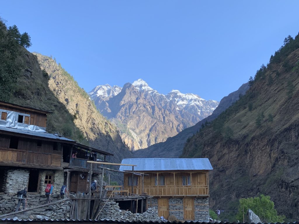
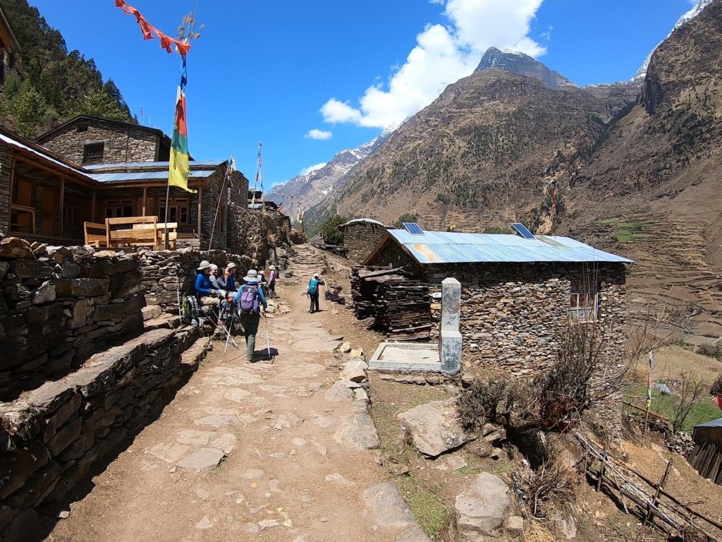
One of the longer trekking days, this stretch delivered dramatic scenery. I crossed roaring rivers, climbed endless stone staircases, and hugged cliffside trails high above the gorge. Subtle cultural changes appeared… prayer flags, mani stones. Reaching Jagat felt like entering a true Himalayan village.
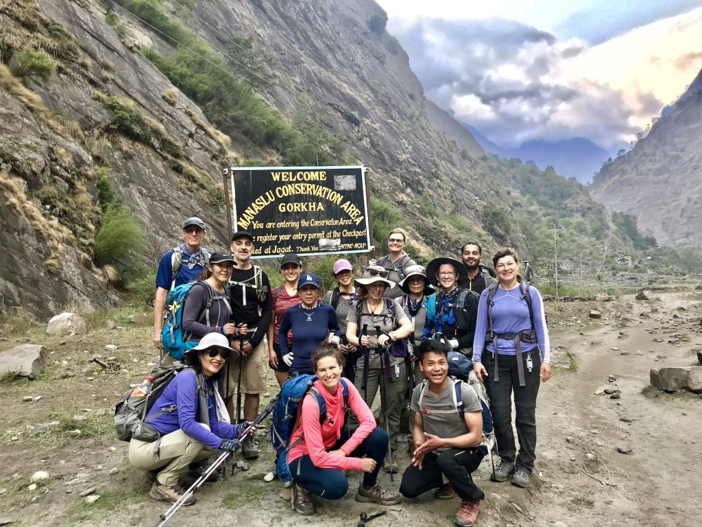
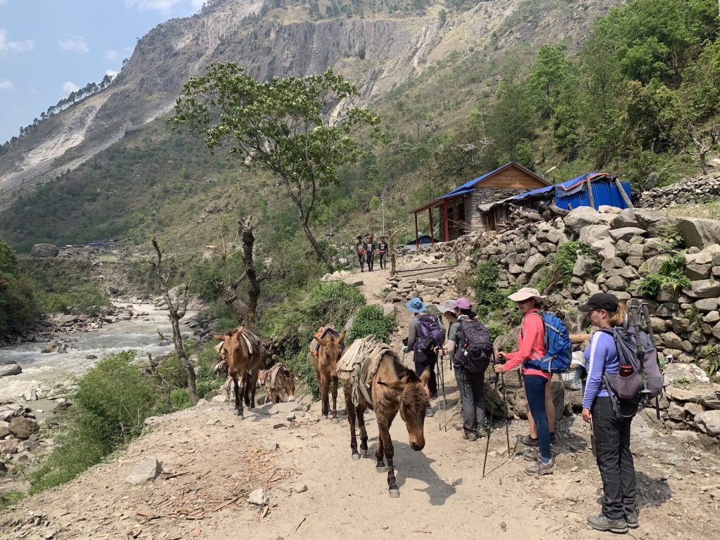
Day 4: Jagat → Deng
- Distance: ~12 miles
- Elevation gain: ~2,600 ft
- Ending elevation: ~6,100 ft
Today we officially entered the restricted Manaslu region. The trail climbed steadily through forests and small villages, and the crowds disappeared almost completely. The sense of remoteness grew stronger with every mile, making Deng feel like a quiet outpost tucked into the mountains
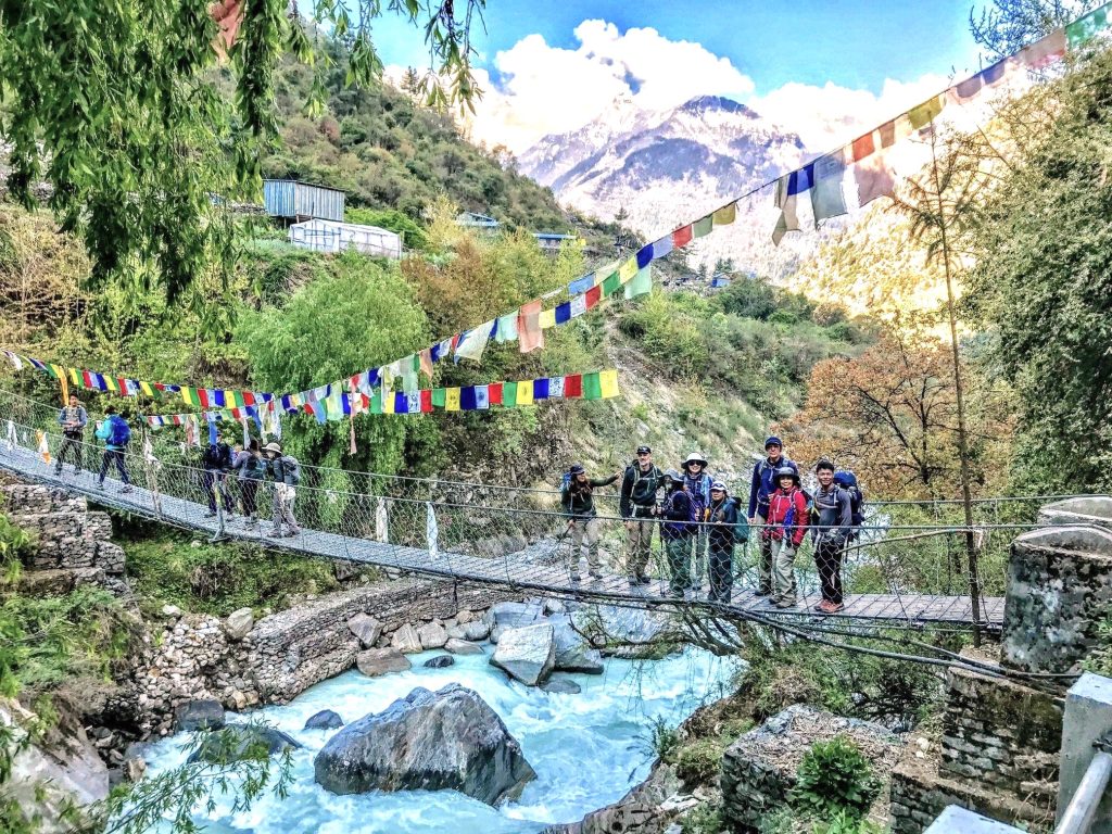
Day 5: Deng → Namrung
- Distance: ~11 miles
- Elevation gain: ~2,000 ft
- Ending elevation: ~8,600 ft
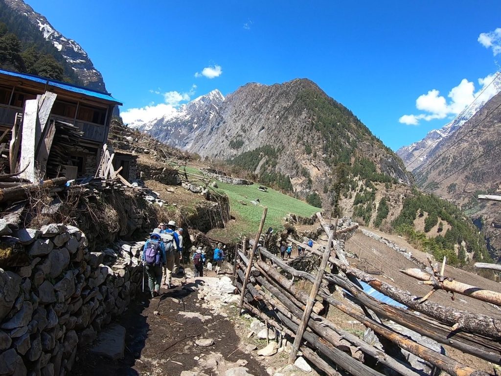
The air cooled noticeably today as we climbed higher. Suspension bridges, pine forests, and carved mani walls marked the trail. Tibetan influence became more pronounced, and by the time I reached Namrung, the mountains felt closer… bigger, sharper, and more commanding.
Day 6: Namrung → Samagaon
- Distance: ~10 miles
- Elevation gain: ~2,900 ft
- Ending elevation: ~11,600 ft
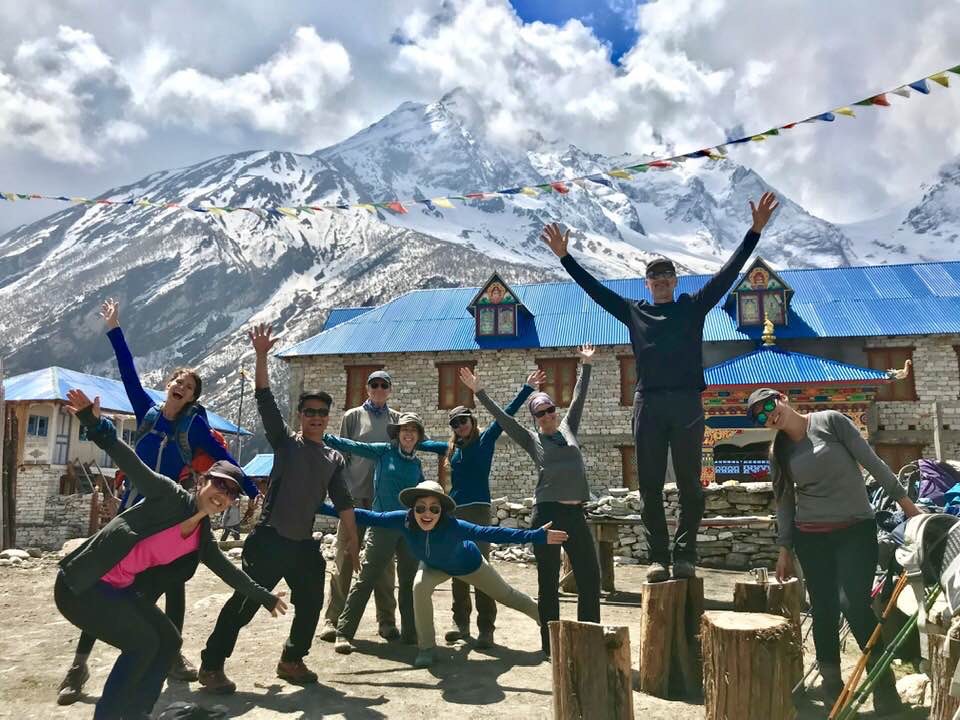
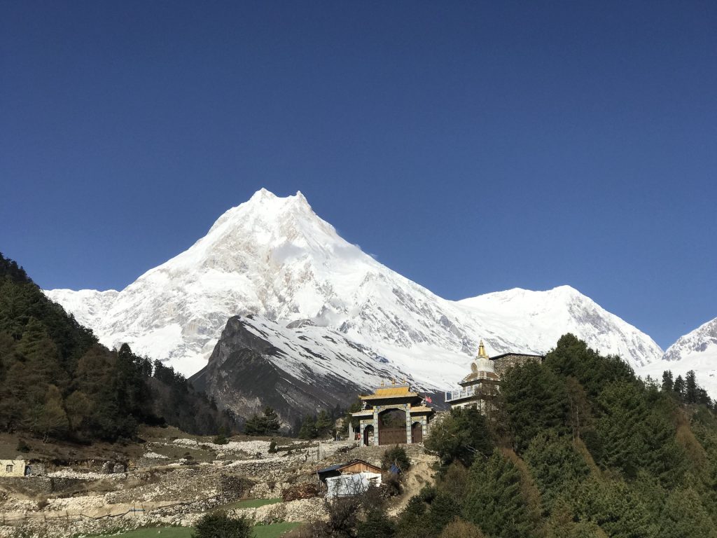
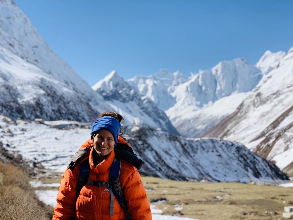
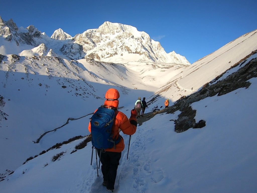
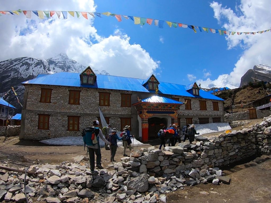
This was one of the most spectacular days of the trek. Snow-capped peaks towered above the trail, and for the first time, I had clear, jaw-dropping views of Mount Manaslu itself. Samagaon is a stunning high-altitude village surrounded by glaciers and massive Himalayan giants — a place that makes you stop and stare.
Day 7: Acclimatization Day in Samagaon
- Distance: ~3–6 miles (optional hikes)
- Elevation gain: ~1,500–2,000 ft
- Sleeping elevation: ~11,600 ft
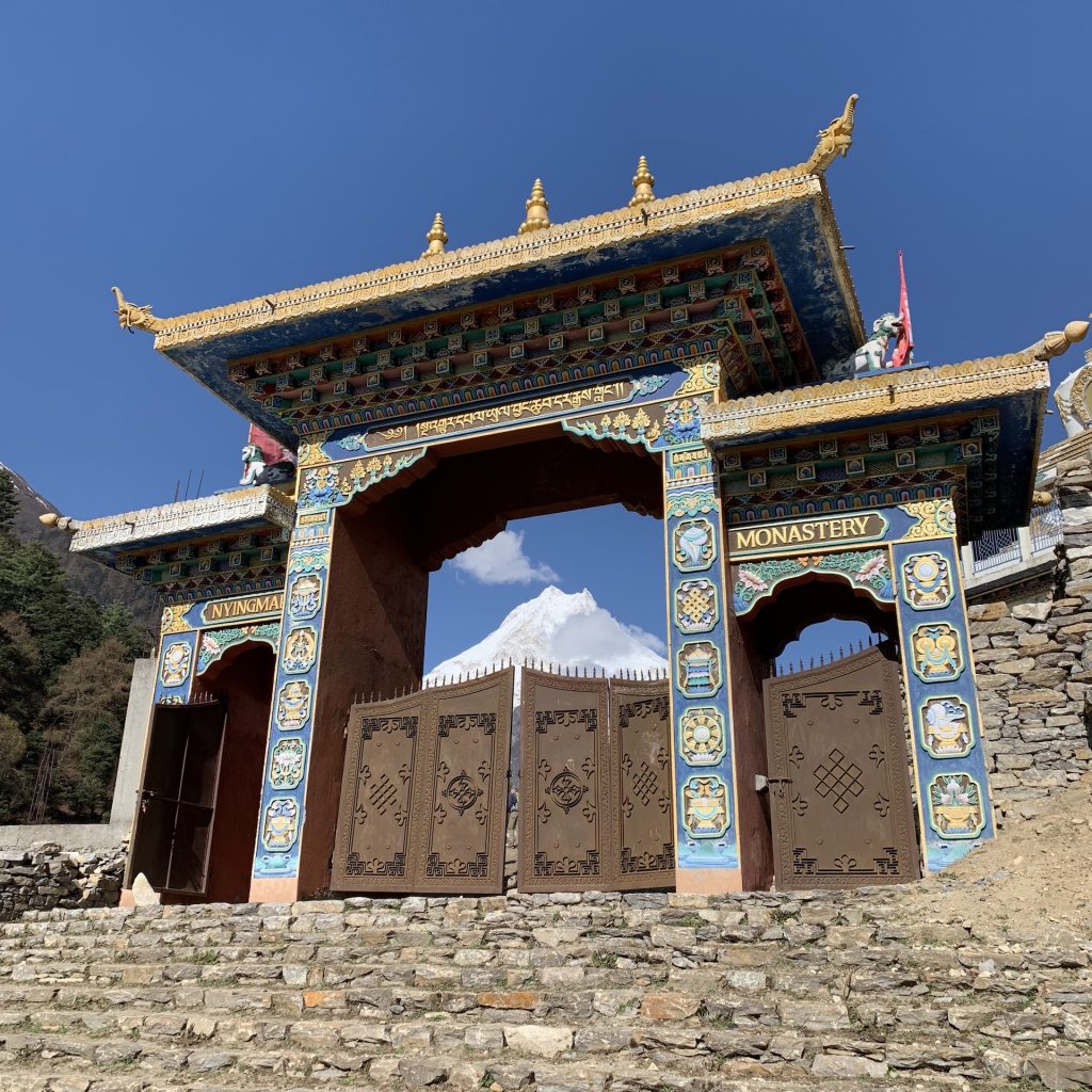
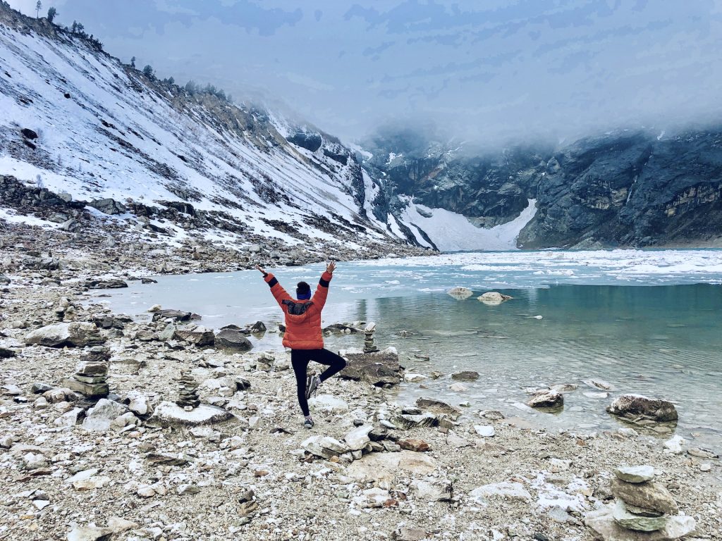
Instead of pushing higher, I spent the day hiking to nearby viewpoints and visiting Pungyen Gompa, an ancient monastery beneath Manaslu’s glaciers. This acclimatization day was essential, giving my body time to adjust while still delivering some of the best views of the entire trek.
Day 8: Samagaon → Samdo
- Distance: ~5 miles
- Elevation gain: ~1,200 ft
- Ending elevation: ~12,700 ft
Short but stunning, today’s hike crossed a wide, windswept valley that felt almost lunar. The landscape was stark and beautiful, with massive peaks in every direction. Samdo is a tiny village near the Tibetan border, where life feels tough, resilient, and deeply traditional.
Day 9: Samdo → Dharamsala (Larkya Phedi)
- Distance: ~4 miles
- Elevation gain: ~2,000 ft
- Ending elevation: ~14,600 ft
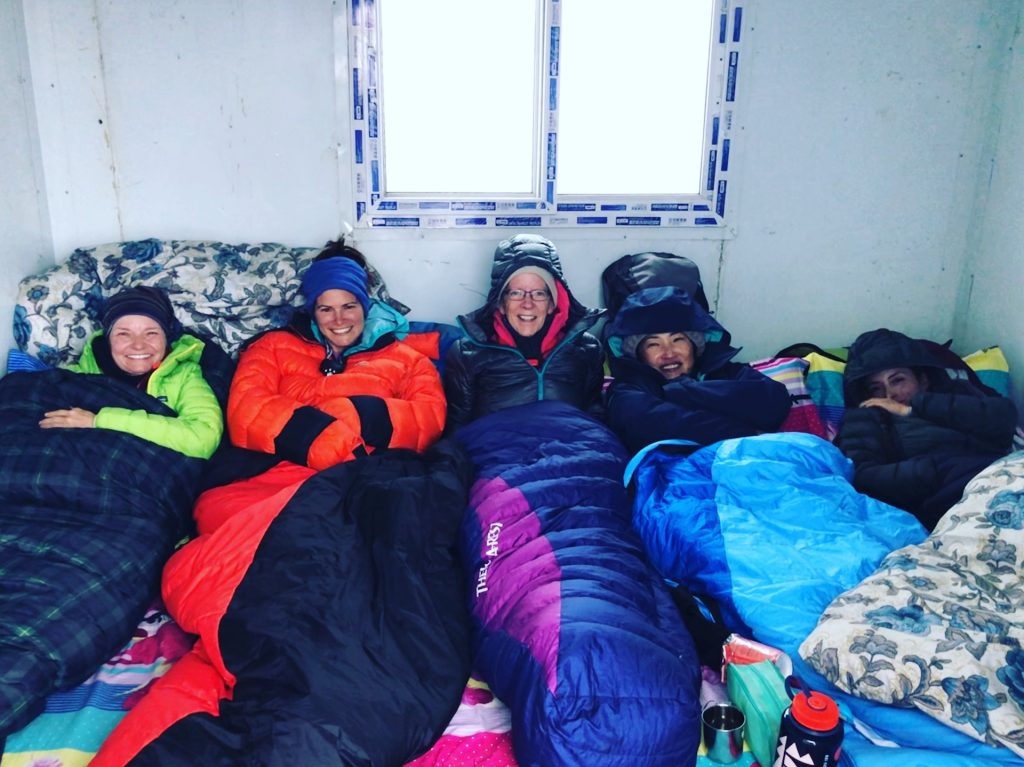
We climbed slowly to Dharamsala, the high camp below Larkya La Pass. The air was thin, the lodge was basic, and everything revolved around resting, hydrating, and mentally preparing for the biggest day of the trek.
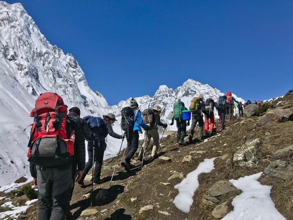
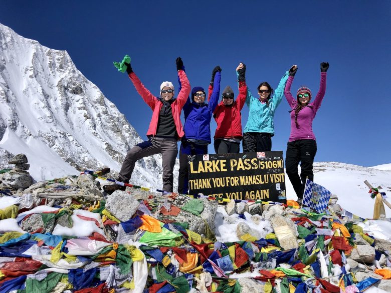
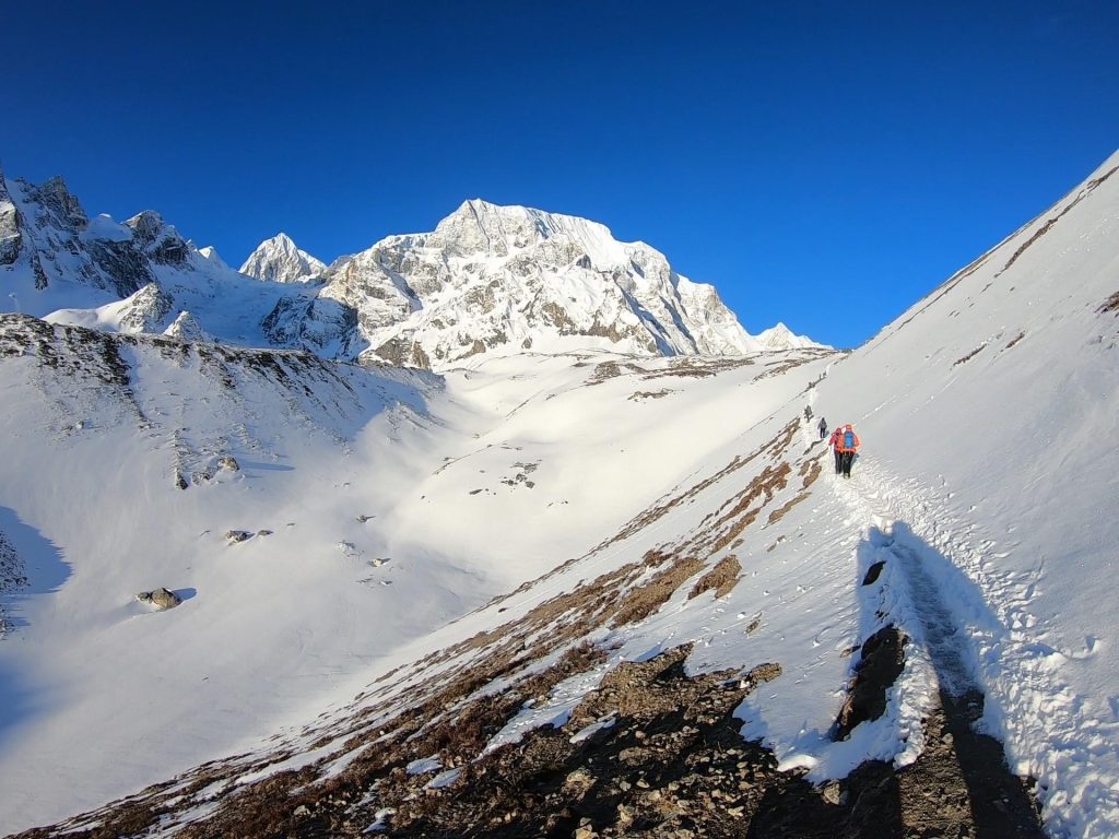
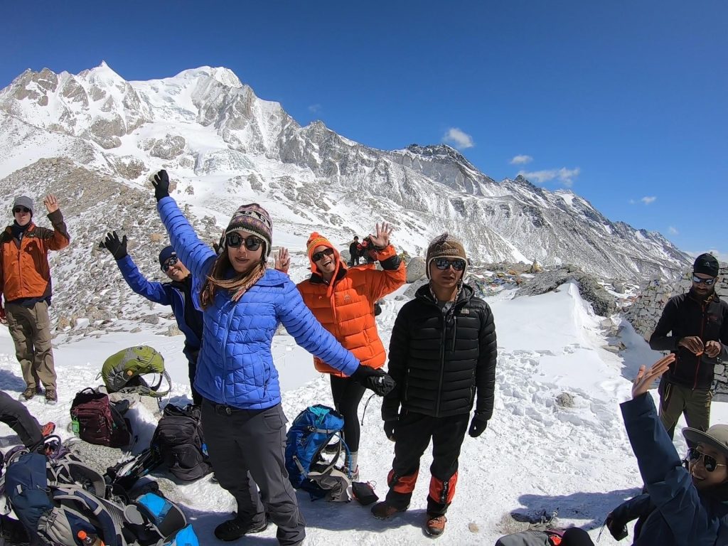
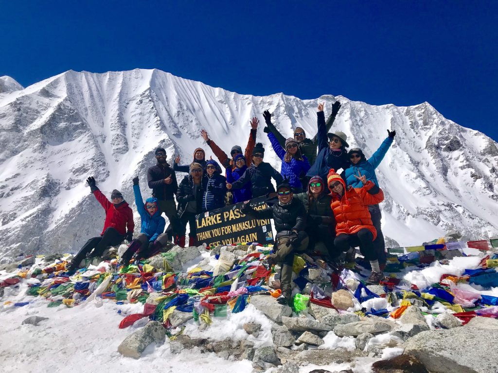
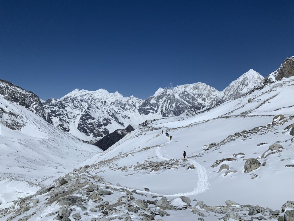
Day 10: Dharamsala → Larkya La Pass → Bhimtang
- Distance: ~15 miles
- Elevation gain: ~2,400 ft
- Elevation loss: ~5,300 ft
- Highest point: 16,750 ft (Larkya La Pass)
Pass day. We started before sunrise, hiking by headlamp over icy terrain. Reaching Larkya La Pass was surreal… prayer flags snapping in the wind, glaciers below, and endless Himalayan peaks in every direction. The long descent to Bhimtang was exhausting but euphoric, filled with pure accomplishment.
Day 11: Bhimtang → Tilije
- Distance: ~11 miles
- Elevation loss: ~4,900 ft
- Ending elevation: ~7,500 ft
After the intensity of the pass, today felt like a gift. We descended through alpine meadows and forests, slowly re-entering greener terrain. With every step downward, breathing got easier and energy returned.
Day 12: Tilije → Dharapani
- Distance: ~7 miles
- Elevation gain: ~800 ft
- Ending elevation: ~6,100 ft
A mellow final trekking day through forests, villages, and waterfalls. We officially connected with the Annapurna region here, and the realization that the trek was ending felt both bittersweet and satisfying.
Day 13: Dharapani → Kathmandu
- Hiking: None
- Driving distance: ~120 miles
We traded trail shoes for vehicle seats and made the long journey back to Kathmandu — tired, proud, and already reminiscing.
Manaslu Circuit Trek Overview
- Total distance: ~110–120 miles
- Total trekking days: 12–14
- Maximum elevation: 16,750 ft
- Total elevation gain: ~30,000+ ft
What to Pack for the Manaslu Circuit Trek
🥾 Trekking Gear
- Waterproof hiking boots
👉 Click to Buy
- Trekking poles
👉 Click to Buy
- 30–40L backpack
👉 Click to Buy
- Headlamp
👉 Click to Buy
👕 Clothing (Layering System)
- Thermal base layers
👉 Click to Buy
- Insulating mid-layer
👉 Click to Buy
- Down jacket
👉 Click to Buy
- Waterproof shell jacket & pants
👉 Click to Buy
- Warm hat, gloves, buff
👉 Click to Buy
- Wool hiking socks
👉 Click to Buy
❄️ High-Altitude Essentials
- Microspikes or crampons
👉 Click to Buy
- Sleeping bag rated to −15°C
👉 Click to Buy
- UV-protective sunglasses
👉 Click to Buy
Miscellaneous
- Water filter or purification tablets
👉 Click to Buy
- Power bank or solar charger
👉 Click to Buy
- First aid kit + altitude meds
👉 Click to Buy
- Sunscreen & SPF lip balm
👉 Click to Buy
Final Thoughts: Is the Manaslu Circuit Trek Worth It?
Without hesitation… yes!!!
The Manaslu Circuit Trek delivers towering Himalayan scenery, rich culture, real challenge, and unforgettable moments of quiet awe. It’s one of the best treks in Nepal for hikers who want something adventurous, meaningful, and truly wild.
If you’re planning a trek in Nepal and want an experience that stays with you long after the trail ends… Manaslu is it.
Affiliate Disclosure
Some of the links in this post are affiliate links. This means that if you click on a link and make a purchase, I may earn a small commission at no extra cost to you. I only recommend gear, products, and services that I personally use, trust, or genuinely believe will add value to your hiking and travel experiences.
These commissions help support this blog and allow me to continue creating free, detailed trekking guides and content. Thank you for supporting my work and adventures… it truly means a lot!